
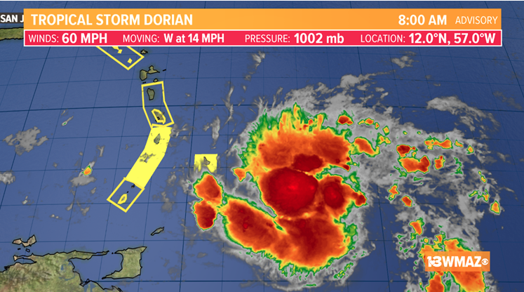
After a night of slight strengthening, Tropical Storm Dorian has winds up to 60 mph as of the 8 a.m. Monday morning update from the National Hurricane Center.
Dorian is a compact storm, but is becoming better organized on it’s approach to the Windward Islands where Hurricane Watches and Warnings have been posted.
The latest forecast cone from the NHC continues gradual strengthening through much of this week. By Thursday morning Dorian is forecast to reach category 1 hurricane strength as it moves closer to Puerto Rico and Hispaniola. The NHC has stated that Watches may need to be issued for these areas at some point on Monday.

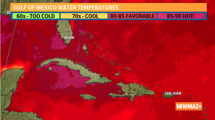
However, we do need keep in mind that water temperatures in this region are currently quite warm, so restrengthening cannot be ruled out once the system returns to a more suitable environment.
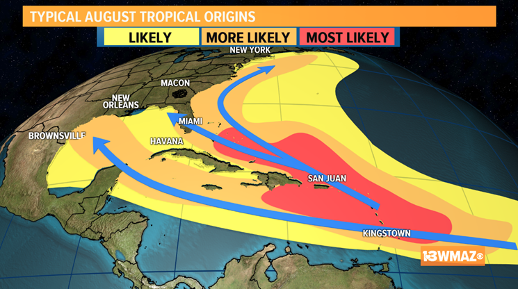
Then the big question is will this be a threat to the United States? At this point in the game it’s just too early to know. Some forecast models are suggesting that the potential is there, but our skill in forecasting tropical systems this far in advance is very low.

Typical paths for storms in this area of the Atlantic at this time of year include a westward track towards Florida and the Gulf, and a more eastern track that stays off the east coast.
Be sure to stay tuned to the forecast through this week. We’ll be sure to keep you up to date with the latest.