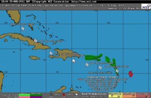
A large tropical wave is located about 250 miles east of the lesser antilles, it moving westward to west-northwestward at about 20 mph. This system shows signs of organization… and surface observations indicate that pressures are low in the area.
However there is no evidence of a surface circulation at this time. Slow development of this system is likely… and a tropical depression could form at any time over the next couple of days. The probability that this system becomes a tropical cyclone within the next 48 hours is 90%.
An air force reserve hurricane hunter aircraft is en route to investigate this system.
Although this system is located 891 miles (1.433 km) from Port-au-Prince [it is expected to Haiti within 3-4 days, if its speed and trajectory remain], the weather service in Haiti have activated the pre-alert level orange, this Saturday at 10am (i.e. risk of impact of intensity few violent to violent) faced to the persistent threats of heavy rains, gusts of wind, with risk of rockfalls, landslides and floods.
All the forecast models show, currently, that the South regions could be the most affected, but this remains to be confirmed according to the evolution of the system and its trajectory in the coming days.
