Conditions in the Pacific and ultra-warm Atlantic are ripe for a harvest of tropical storms, forecasters are warning
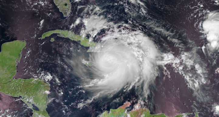
The 2024 Atlantic hurricane season is likely to be destructive and costly and has the potential to be one of the busiest on record.
That’s the consensus of at least four major forecasting services, all of whom point to conditions in the tropical Pacific and in the Atlantic hurricane formation zone that are ripe for a tropical storm harvest.
The latest to join the chorus were the meteorologists who assembled the outlook for the Weather Channel, who on Thursday called for 24 named storms, those with winds of 39 mph or higher, and 11 hurricanes, with winds of at least 74 mph. Of those, six are forecast to be “major” hurricanes, with peak winds of 111 mph or higher.
The long-term averages are 14 named storms and seven hurricanes, with three of those major.
The Weather Channel outlook has a copy-and-paste similarity to forecasts issued in the last few weeks by AccuWeather Inc.; the Colorado State University Tropical Meteorology Project; and Tropical Storm Risk, a British firm.
Record-high sea-surface temperatures have persisted in the Atlantic hurricane spawning grounds, and as of Thursday they were running several degrees above normal levels, according to NOAA data.
Human-caused climate change certainly is a factor, with natural variability likely a contributor — and cleaner air, researchers say. Amy Clement, a professor and researcher at the University of Miami’s School of Marine, Atmospheric, and Earth Science, is among those who have noted that erasing veils of pollutants has enhanced the amount of solar energy reaching the surface.
“While, obviously cleaning up the air is a good thing,” said Colorado State hurricane specialist Philip Klotzbach “it has likely helped fuel the more active Atlantic hurricane seasons that we’ve seen in recent years.”
Heat is fuel for hurricanes. The Atlantic was quite warm last season also, but conditions of the Pacific may have had some mitigating effects, and the tropical storm season, although active in terms of raw storm numbers, wasn’t especially ferocious.
A cooldown in the Pacific could boost hurricane traffic
The evolving state of the tropical Pacific will end up constituting the biggest difference between the 2023 and 2024 seasons, forecasters say.
The El Niño warming, which covered a vast expanse of the equatorial Pacific and typically generates west-to-east upper-air winds that had a shearing effect on would-be tropical storms in the Atlantic Basin, is waning.
Its mirror-opposite, a La Niña cooling, is likely to develop in time for the peak hurricane season, says the government’s Climate Prediction Center. La Niña tends to have dampening effects on the shearing winds.
In short, say hurricane forecasters, a cool Pacific and warm Atlantic could brew trouble for the Caribbean and the Gulf and Atlantic Coasts.
That’s not a done deal. Concentrations of storm-repelling Saharan dust in the atmosphere have been “especially pronounced this year,” said Klotzbach, and “that could at least slow down the start of the season,” which begins officially on June 1.
Here is a summary of the outlooks by major services for named storms, hurricanes, and major hurricanes in the Atlantic Basin:
-
AccuWeather: 20 to 25 named storms, 8 to 12 hurricanes, 4 to 7 major hurricanes
-
Colorado State University: 23 named storms, 11 hurricanes, 5 major hurricanes
-
Weather Channel: 24 named storms, 11 hurricanes, 6 major hurricanes
-
Tropical Storm Risk: 23 named storms, 11 hurricanes, 5 major hurricanes
-
Long-term average, according to the National Hurricane Center: 14 named storms, 7 hurricanes, 3 major hurricanes
-
Records, according to Colorado State: 30 named storms (2020), 15 hurricanes (2005), 7 major hurricanes (2005)
